
How Accurate Is Drone Surveying Compared to Traditional Methods?
When you manage construction, land development, or infrastructure projects, survey accuracy shapes every decision you make. Design quality, material quantities, timelines, and compliance all depend on reliable survey data.
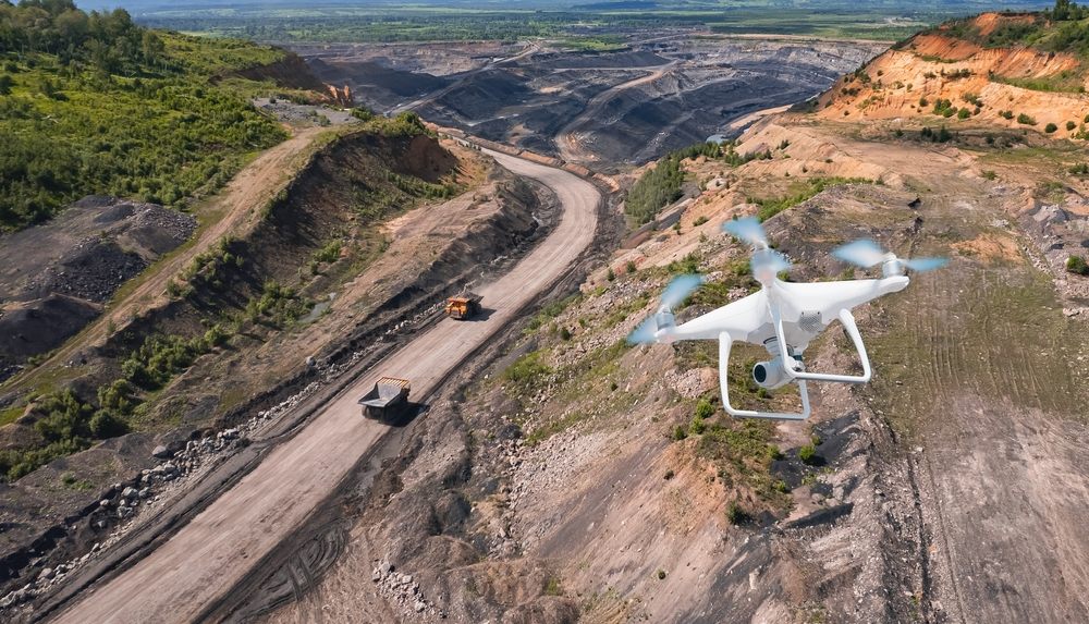
Drone surveying is now common across construction surveying in Dubai and other fast-growing markets. Traditional land surveying is still trusted and widely used. You need to understand how these two methods compare, not in theory, but in real project conditions.
This article explains how accurate drone surveying is compared to traditional methods and compares both approaches based on speed, accuracy, cost, features, safety, insights, and site accessibility.
What Survey Accuracy Means for You
Survey accuracy tells you how close measured data is to the actual ground position. It affects how confident you can be in your drawings, models, and quantities.
You need to look at two types of accuracy.
- Horizontal accuracy, which shows how precisely locations are measured.
- Vertical accuracy, which shows how accurate elevations and levels are.
Most construction and engineering work requires centimeter-level survey accuracy. In Dubai, survey data often needs to meet Dubai Municipality survey standards. Drone Surveying and Mapping in Dubai and traditional survey methods can both meet these requirements, but they achieve accuracy in very different ways.
Accuracy Comparison: Drone Surveying vs Traditional Surveying
When you compare accuracy, the main difference comes from how data is collected. Traditional land survey accuracy is achieved through direct ground measurement. Drone land survey accuracy is achieved through aerial data supported by control points measured on the ground.
Traditional Survey Accuracy
When you rely on traditional surveying methods, accuracy comes from precise instruments used at fixed locations. Total stations measure distances and angles directly, which allows you to achieve millimeter-level precision at specific points. This level of accuracy is especially important when you are setting out structures, defining boundaries, or controlling critical construction elements.
GPS and GNSS surveying systems also provide strong results. RTK GPS surveys typically achieve horizontal accuracy within 1 to 2 centimeters, while vertical accuracy usually stays within 2 to 3 centimeters. These results are consistent and trusted across the industry.
Traditional methods give you very accurate point measurements. When accuracy at exact locations matters more than overall surface detail, traditional surveying remains the most reliable option.
Drone Survey Accuracy
Drone surveying approaches accuracy differently. Instead of measuring individual points, drones collect continuous data across the entire site. This data is then processed using UAV mapping and data processing software and tied to the ground using control points.
When you use drone photogrammetry with proper ground control, horizontal accuracy typically reaches between 1 and 3 centimeters. Vertical accuracy usually falls between 2 and 5 centimeters. These results are well within acceptable limits for most construction and engineering applications.
LiDAR drone surveying delivers similar performance, especially for elevation data and uneven terrain. When RTK drone accuracy is used, positioning becomes more consistent and the need for extensive ground control is reduced.
Drone surveys may offer slightly less precision at individual points compared to total stations. However, they provide accurate surface data across the entire site, which gives you a more complete and practical understanding of real ground conditions.
Speed Comparison: Drone Surveying vs Traditional Surveying
Speed is crucial when you need survey data to make timely decisions. Faster results mean you can move forward with planning, design, or construction without delays.
Traditional Survey Speed
Traditional surveying can be time-consuming because surveyors must collect data point by point. For large sites, this process can take several days. Key points to note:
- Surveyors must physically access each measurement location
- Large sites require multiple days of fieldwork
- Data processing only begins after field measurements are completed
- Overall, data delivery for large projects can take several days or more
Drone Survey Speed
Drone surveys are much faster and allow you to capture the entire site efficiently. With drones, you can:
- Capture large areas in a single flight
- Reduce field time from days to just a few hours
- Start data processing immediately after flight
- Quickly generate maps, 3D models, and measurements
- Make faster decisions without compromising accuracy
For large-scale land surveys or active construction sites, drones let you move quickly while still getting reliable, usable survey data.
Cost Comparison: Drone Surveying vs Traditional Surveying
Cost is more than just the equipment you buy. You also need to consider labor, time, and the risk of rework. Understanding how traditional and drone surveying compare can help you make smarter budgeting decisions.
Traditional Survey Cost
Traditional surveys involve more on-site effort and take longer to complete. Key cost factors include:
- Skilled survey teams needed on site
- Longer field hours for large areas
- Repeat visits to update or verify data
These factors increase labor costs and can make traditional surveying expensive, especially on large or active construction sites.
Drone Survey Cost
Drone surveys reduce many of the costs associated with traditional methods. With drones, you can:
- Cut down field labor time significantly
- Minimize the number of site visits required
- Reduce delays that increase overall project cost
While investing in drone technology is necessary, the overall project cost is often lower, particularly when you need frequent site updates or large-scale surveys.
Features Comparison: Drone Surveying vs Traditional Surveying
The type and quality of data you collect determine how effectively you can plan, monitor, and manage your project. Choosing the right survey method affects not just accuracy, but also the insights you can act on.
Traditional Survey Features
Traditional surveying gives you extremely precise measurements at selected points. It is best when you need control and legal reliability. Here is what you get:
- Highly accurate point measurements: Ideal for layout, boundaries, and setting out structures.
- Clear boundary and layout data: Ensures compliance with legal and municipal requirements.
- Control points for design and construction: Provides reliable reference for engineers and contractors.
- Data consistency at measured points: Each measurement is verified and precise.
- Limited surface coverage: Only measured points are precise; the areas in between require interpretation.
Traditional surveys give you confidence for critical tasks but require extra effort to visualize and understand the full site.
Drone Survey Features
Drone surveying captures entire surfaces and provides a richer set of data, allowing you to see more than just points. With drones, you get:
- Full topographic surfaces: Complete site representation, not just selected points.
- High-resolution orthophotos: Accurate aerial imagery for planning and reporting.
- 3D point clouds and models: Enables better visualization of terrain, slopes, and structures.
- Volume and cut-fill analysis: Quickly calculate earthwork quantities for construction planning.
- Repeatable mapping: Capture frequent updates without repeating manual field measurements.
- Better context and site understanding: Identify obstacles, drainage, and vegetation that might affect construction.
- Data integration with BIM or GIS: Easily incorporate drone data into your digital planning tools.
Drone surveys give you a complete picture of the site. They allow you to make faster decisions, identify potential issues before they occur, and reduce the need for multiple field visits.
Safety Comparison: Drone Surveying vs Traditional Surveying
Safety is a top priority on any construction project. Surveying methods affect not only your team’s well-being but also your schedule, costs, and liability. Choosing the right method can reduce risk while keeping work on track.
Traditional Survey Safety
Traditional surveying often requires your team to be physically present on the site. This exposes them to multiple hazards, including:
- Working near heavy machinery: Surveyors may need to take measurements close to moving equipment.
- Navigating unstable ground: Uneven terrain, excavations, or soft soil increases the risk of slips or falls.
- Operating close to traffic or active works: Surveyors can be exposed to vehicles or ongoing construction activities.
- Extended exposure times: Longer field hours increase the likelihood of accidents.
While experienced survey teams can manage these risks, the exposure is inherent in point-based, ground-level measurements.
Drone Survey Safety
Drone surveying significantly reduces these risks by keeping your team off the ground in hazardous areas. Benefits include:
- Remote data capture: Most measurements and mapping are done from a safe distance.
- Fewer personnel needed on site: Smaller field teams mean fewer people are exposed to hazards.
- Reduced exposure to unsafe conditions: No need to walk through excavations, slopes, or heavy traffic zones.
- Faster, safer surveys: Less time on site reduces the chance of accidents.
For complex, active, or large-scale construction projects, drones provide safer, faster, and more efficient surveying without sacrificing accuracy.

Insights Comparison: Drone Surveying vs Traditional Surveying
Accuracy is important, but so is understanding your site as a whole. The insights you gain affect planning, design, and construction decisions.
Insights from Traditional Surveys
Traditional surveys provide precise measurements, but only at the points you collect data. Key benefits include:
- Accurate measurements at selected locations
- Clear control data for engineering and design tasks
- Reliance on interpretation between points
While you get high precision, you may miss how the site behaves between measured points.
Insights from Drone Surveys
Drone surveys give you a complete view of the site, helping you see patterns and conditions that are otherwise hard to capture. With drones, you get:
- Continuous surface visibility across the entire site
- Visual context through high-resolution aerial imagery
- Better understanding of slopes, drainage, and overall site conditions
- Deeper insight for planning, progress tracking, and decision making
Drone surveys give you a level of situational awareness that is difficult to achieve with point-based traditional surveys.
Site Accessibility Drone Surveying vs Traditional Surveying Comparison
Not every site is easy to reach, and accessibility affects both speed and accuracy of surveys. Choosing the right method depends on the terrain and site conditions.
Traditional Survey Accessibility
Traditional surveys rely on surveyors being able to reach each measurement point safely. Key limitations include:
- Physical access required to every measured point
- Safe ground conditions must be maintained
- Difficult or uneven terrain slows work and limits overall coverage
Challenging sites can significantly increase time and cost when using traditional methods.
Drone Survey Accessibility
Drones overcome many accessibility challenges. With drones, you can:
- Survey large open areas quickly
- Capture data over rough, uneven, or hard-to-reach terrain
- Work in restricted or sensitive zones without putting people at risk
This makes topographic survey drone services ideal for complex, remote, or active construction sites where traditional surveys are difficult.
Practical Accuracy Needs for Construction Surveying Dubai
In Dubai, construction projects often have tight timelines and strict regulatory standards. Survey accuracy is critical to meet project requirements and avoid delays or rework.
Drone surveys are widely used in Dubai because they allow you to capture accurate site data quickly. With drone technology, you can:
- Perform detailed topographic mapping
- Calculate earthworks and material volumes efficiently
- Verify construction progress in real time
When you combine drone surveys with GPS and GNSS control points, you can achieve survey-grade accuracy that meets both project and Dubai Municipality standards. Pro Drone Services in Dubai offer this capability, making drones a practical and reliable solution for construction surveying in the region.
When Traditional Surveying Is the Better Choice
Even though drone surveying is fast and efficient, there are situations where traditional surveying is still the better option. You should rely on traditional methods when:
- Setting legal boundaries that require exact measurements
- Performing high-precision layout work for structures or infrastructure
- Establishing control networks for future surveys
Traditional methods remain essential whenever millimeter-level accuracy is required to ensure compliance, safety, and precision on your projects.
When Drone Surveying Is the Better Choice
Drone surveying is ideal for many modern construction and land development projects. You should consider using drones when:
- Working on large-scale land surveys where traditional methods would take too long
- Needing fast and repeatable data for ongoing monitoring
- Managing active construction sites with safety or access challenges
- Requiring full site visibility for planning, progress tracking, or analysis
Drone surveys give you speed, safety, and reliable accuracy, making them the practical choice for most planning and monitoring tasks.
Final Answer
Drone surveying is slightly less precise at individual points than traditional total station surveys. However, with RTK drone accuracy, LiDAR sensors, and properly surveyed ground control points, drone surveys achieve reliable centimeter-level accuracy.
For construction surveying, topographic mapping, and large-scale land surveys, drone surveying gives you accurate data faster, safer, and with better site insight. Traditional surveying remains critical for control and precision tasks.
If you want accuracy that supports real decisions across your entire site, drone surveying is accurate enough to be a dependable part of your workflow.
Frequently Asked Questions (FAQs)
How accurate are drone surveys?
Drone surveys can achieve centimeter-level accuracy when using RTK drones, LiDAR sensors, and properly placed ground control points (GCPs). Photogrammetry without control points is less accurate, typically 5–20 cm, but still useful for preliminary planning.
Which method of survey is the most accurate?
For individual points, traditional total station surveys are the most accurate, often reaching millimeter-level precision. RTK GPS surveys are also highly accurate, achieving 1–2 cm horizontally and 2–3 cm vertically.
What is the most accurate land survey method?
The most accurate land survey methods are total station surveys and static GPS surveys, which provide extremely precise point measurements. Drone surveys can match GPS-level accuracy when properly controlled but may be slightly less precise at individual points.
What are the limitations of drone surveying?
Drone surveys have some limitations:
- Slightly lower point precision compared to total stations
- Accuracy depends on GPS signal and GCP placement
- Weather conditions like high wind or rain can delay flights
- Indoor, underground, or highly obstructed areas are challenging to survey
Are drone surveys worth it?
Yes. Drone surveys are worth it for large-scale sites, frequent progress monitoring, and complex terrain. They save time, improve safety, reduce field labor, and provide comprehensive site insight while still delivering survey-grade accuracy when properly executed.
What is the 1 to 1 rule drone?
The 1 to 1 rule in drone surveying refers to image overlap in photogrammetry. For accurate 3D models, you should aim for at least 80% front overlap and 60% side overlap, ensuring each point on the ground appears in multiple images. This improves accuracy and reduces errors in the final model.