
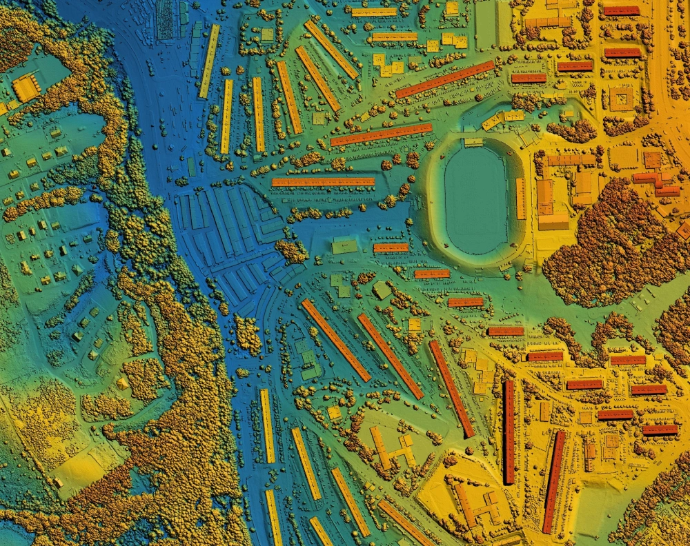
How LiDAR Technology Works: Principles and Applications
LiDAR, short for Light Detection and Ranging, is a technology used to measure distances with exceptional accuracy and create detailed three-dimensional maps. By capturing precise spatial information, LiDAR has become essential in urban planning, construction, autonomous transportation, environmental monitoring, and disaster management.
In a city like Dubai, where rapid urban development, iconic skyscrapers, and smart city initiatives are transforming the landscape, understanding LiDAR is especially important. This article explores how LiDAR works, the principles that guide it, its main components, the different types of systems, how data is collected and processed, and its practical applications in real-world projects.
What is LiDAR?
At its core, LiDAR is a remote sensing technology. It measures distances using pulses of light emitted by a laser. When these light pulses hit an object, they reflect back to a sensor. By calculating the time it takes for the light to return, LiDAR can determine the distance between the sensor and the object. Unlike traditional surveying techniques, LiDAR is extremely fast and precise, capable of producing detailed three-dimensional representations of the environment.
LiDAR can scan large areas quickly and detect fine details such as road edges, building facades, or desert dunes. It works in combination with GPS and inertial measurement units (IMUs) to map objects accurately in three-dimensional space.
Principles of LiDAR Technology
LiDAR works on the time-of-flight principle, which is the foundation of its precise measurements. The process is straightforward:
- A laser emits a pulse of light.
- The pulse travels to the target and reflects back.
- A sensor detects the returned pulse.
- The system calculates the distance based on the speed of light and the time it took for the pulse to return.
The formula used is:
Distance = (Speed of Light × Time of Flight) ÷ 2
The division by two accounts for the round trip of the laser pulse from the sensor to the target and back. Modern LiDAR systems can emit millions of pulses per second, capturing extremely dense and accurate data. This allows the creation of detailed three-dimensional maps of complex environments, from urban skyscrapers to desert landscapes.
LiDAR also measures reflection intensity. Different surfaces reflect laser light differently, which helps the system identify various materials. For example:
- Smooth surfaces, such as water, reflect less laser energy.
- Rough surfaces, such as concrete, sand, or vegetation, reflect more energy.
By analyzing the intensity of reflections, LiDAR can distinguish between roads, buildings, trees, and water bodies. This capability makes it an invaluable tool for urban planning, environmental monitoring, and infrastructure management, which is why many Drone Surveying and Mapping Companies rely on LiDAR for high-precision data collection.
Understanding how a LiDAR system is built
A LiDAR system relies on three main components to collect accurate spatial data:
1. Laser Source
The laser is the core of a LiDAR system. It emits rapid pulses of light that travel to the target and reflect back to the sensor. Different LiDAR systems use lasers with different wavelengths depending on the application. For instance, green lasers are commonly used in bathymetric LiDAR to measure water depths, while near-infrared lasers are used for mapping land surfaces and urban areas.
2. Scanner and Optics
The scanner controls the direction and coverage of the laser pulses. In mechanical scanners, rotating mirrors redirect the laser beams to cover a wide area. Solid-state scanners use electronic beam steering with no moving parts, making them more compact, durable, and suitable for applications like autonomous vehicles. The choice of scanner affects the resolution, range, and speed of data collection.
3. GPS and Inertial Measurement Unit (IMU)
To accurately position each laser pulse, LiDAR systems rely on GPS and an Inertial Measurement Unit (IMU). The GPS determines the exact location of the LiDAR device, while the IMU measures its orientation, including pitch, roll, and yaw. By combining this information, LiDAR ensures that every point captured in the point cloud is correctly placed in three-dimensional space, allowing precise mapping of buildings, roads, terrain, and natural features.
How LiDAR Collects Data
LiDAR collects spatial data through a precise workflow that transforms millions of laser pulses into detailed three-dimensional maps. The process involves the following steps:
1. Emission of Laser Pulses
The LiDAR system emits millions of laser pulses per second toward the target area. These pulses travel at the speed of light and interact with objects in their path.
2. Reflection Detection
When a laser pulse hits a surface, it reflects back to the LiDAR sensor. The system measures the time it takes for each pulse to return. Using the time-of-flight principle, it calculates the distance to the object with high accuracy.
3. Geospatial Positioning
Each laser pulse is tagged with precise coordinates using GPS and orientation data from the IMU (Inertial Measurement Unit). This ensures that every measurement is correctly located in three-dimensional space.
4. Point Cloud Generation
Every reflected laser pulse creates a single point in space. Collectively, millions of points form a point cloud, which represents the scanned area in rich detail. Each point carries X, Y, and Z coordinates, and often includes additional information such as reflection intensity and color.
Point clouds can represent a wide range of environments from urban skyscrapers and roads to desert dunes and coastal zones. In Dubai, this capability allows precise mapping of city infrastructure, construction sites, and natural landscapes, supporting urban planning, environmental monitoring, and infrastructure management.
Processing LiDAR Data
Raw LiDAR data, while highly detailed, cannot be used directly. It requires several processing steps to transform millions of points into meaningful maps and models. The main steps include:
1. Filtering
Filtering removes unwanted noise from the dataset. This can include points caused by birds, atmospheric interference, or reflections from temporary objects. Clean data ensures accurate analysis and mapping.
2. Classification
During classification, points are grouped into categories such as ground, vegetation, buildings, or water bodies. This step helps distinguish natural terrain from man-made structures and makes the dataset easier to analyze.
3. Georeferencing
Georeferencing aligns the LiDAR data with a geographic coordinate system. By combining GPS and IMU information, each point in the dataset is placed in its exact real-world location, ensuring precision across large areas.
4. Modeling
The classified and georeferenced point cloud is then converted into usable models, including:
- 3D models of buildings, roads, and infrastructure
- Digital Elevation Models (DEM) for terrain analysis
- Digital Surface Models (DSM) showing natural and man-made features
Advanced software tools allow engineers, planners, and architects in Dubai to visualize LiDAR data, integrate it with GIS and CAD systems, and make informed decisions for urban development, infrastructure planning, and environmental management.
Types of LiDAR Systems
LiDAR systems are classified based on the platform they operate from and the scanning technology they use. Each type is suited to specific applications depending on the area, precision required, and environment, with Aerial LiDAR Scanning in Dubai being widely used for urban mapping, coastal monitoring, and large-scale construction projects.
1. Airborne LiDAR
Airborne LiDAR is mounted on airplanes, helicopters, or drones. It is ideal for surveying large areas, such as cityscapes, deserts, or coastal zones. In Dubai, airborne LiDAR is commonly used for mapping construction sites, monitoring urban expansion, and tracking changes along the coastline.
Airborne LiDAR can be further divided into two types:
- Topographic LiDAR: Uses near-infrared lasers to map the ground, buildings, and other man-made structures. It is widely applied in urban planning and infrastructure projects.
- Bathymetric LiDAR: Uses green lasers to penetrate water, allowing mapping of shallow water areas, coastal zones, and seabeds. This type is particularly useful for Dubai’s marinas and artificial canals.
2. Terrestrial LiDAR
Terrestrial LiDAR operates from the ground and is often used for detailed scans of smaller areas. It comes in two main forms:
- Static LiDAR: Placed at a fixed location to scan the surrounding environment. It is ideal for capturing building facades, monuments, and small construction sites.
- Mobile LiDAR: Mounted on vehicles to scan roads, highways, and urban infrastructure while moving.
In Dubai, terrestrial LiDAR is used to monitor skyscrapers, metro tunnels, and busy road networks, providing high-resolution data for urban management and construction oversight.
3. LiDAR Based on Scanning Technology
LiDAR scanners differ in how they direct laser pulses:
- Mechanical LiDAR: Uses rotating mirrors to move the laser in multiple directions. This allows wide coverage but involves moving parts that require maintenance.
- Solid-State LiDAR: Uses electronic beam steering with no moving parts. It is more compact, durable, and suitable for applications like autonomous vehicles and drones.
The choice of scanning technology affects range, resolution, and durability, making it important to select the right LiDAR system for each project.
Applications of LiDAR Technology
LiDAR technology has a wide range of applications in urban, environmental, and infrastructure management. In a rapidly growing city like Dubai, its precision and efficiency make it an essential tool for planning, monitoring, and decision-making.
1. Urban Planning and Smart Cities
LiDAR enables urban planners to create highly accurate 3D models of the city. These models allow:
- Visualization of new construction projects before they are built.
- Simulation of traffic flow and pedestrian movement for better city planning.
- Optimization of infrastructure, such as roads, utilities, and green spaces.
Dubai leverages LiDAR to support its smart city initiatives, ensuring sustainable development and efficient use of resources.
2. Construction Monitoring
LiDAR provides real-time monitoring of construction sites, allowing engineers to:
- Detect deviations from design plans quickly.
- Track construction progress accurately.
- Maintain safety standards, particularly in high-rise buildings and metro tunnels.
Major projects like Dubai Creek Tower and Expo 2020 site development have used LiDAR for precision mapping and monitoring, reducing errors and improving efficiency.
3. Transportation and Autonomous Vehicles
LiDAR is a critical technology for autonomous vehicles, helping them detect obstacles, pedestrians, and road boundaries. Dubai has invested in autonomous vehicle trials and smart transportation systems, where LiDAR ensures safe navigation in complex urban environments.
4. Environmental and Coastal Monitoring
LiDAR is used to map desert dunes, coastal zones, and artificial lakes, providing valuable data on:
- Sand movement and erosion patterns.
- Water levels and coastal changes.
- Environmental hazards and resource management.
Authorities in Dubai rely on LiDAR for coastal protection, desert management, and urban landscaping projects.
5. Disaster Management
LiDAR can predict flood zones, detect unstable terrain, and assess coastal risks. This allows planners and emergency services to prepare early warning systems and evacuation plans. In Dubai, this capability supports disaster preparedness for extreme weather and urban hazards.
6. Heritage and Archaeology
LiDAR can penetrate vegetation and detect hidden or buried structures without physically disturbing the site. This makes it invaluable for preserving historical locations and documenting heritage sites in and around Dubai.
7. Road and Infrastructure Management
LiDAR is used to inspect roads, bridges, and tunnels efficiently. Mobile LiDAR systems mounted on vehicles can scan highways in motion, detecting cracks, potholes, and structural deformations. In Dubai, this technology supports Sheikh Zayed Road monitoring, metro tunnels inspection, and maintenance planning for bridges and flyovers without disrupting traffic.
8. Utilities and Asset Management
LiDAR helps manage power lines, pipelines, and communication networks by mapping their exact locations in 3D. For example, LiDAR can identify vegetation encroaching on power lines or detect pipeline displacement. Dubai’s growing infrastructure network benefits from this precision, reducing maintenance costs and minimizing service interruptions.
9. Forestry and Vegetation Analysis
While Dubai is largely urban, landscaped areas, parks, and artificial forests are common. LiDAR can measure tree height, canopy density, and vegetation health, which supports urban green planning, irrigation management, and biodiversity studies.
10. Mining and Earthworks
LiDAR is widely used for volume calculation and terrain modeling in quarries, sand mines, and earthwork projects. In Dubai, desert development and construction sites benefit from LiDAR to calculate sand and soil volumes accurately, optimizing material transport and site planning.
11. Coastal and Marine Applications
In addition to bathymetric mapping, LiDAR assists with marina design, dredging, and shoreline management. Dubai’s coastal developments, artificial islands, and waterfront projects rely on LiDAR for precise underwater mapping and monitoring sediment movement.
12. Flood and Water Management
LiDAR helps model drainage systems, artificial canals, and flood-prone areas. In Dubai, where artificial water channels and stormwater systems are integrated into urban design, LiDAR provides the data needed for efficient flood prevention and water flow management.
13. Smart Mobility and Traffic Management
By combining LiDAR data with traffic monitoring systems, Dubai can analyze vehicle flow, pedestrian movement, and congestion patterns. This supports smart traffic lights, automated route optimization, and planning for future autonomous vehicle networks.
14. Urban Heat and Energy Efficiency Planning
High-resolution 3D LiDAR maps allow planners to assess building density, roof surfaces, and shading patterns, which is important for energy-efficient building design, cooling requirements, and reducing urban heat islands. Dubai’s hot climate makes this application particularly valuable.
Conclusion
LiDAR technology is a powerful tool for measuring and mapping the physical world. Its principles are simple, based on time-of-flight and light reflection, but its applications are wide-ranging. In Dubai, LiDAR supports urban planning, construction monitoring, smart city development, environmental management, and autonomous transportation. By producing accurate three-dimensional data quickly and efficiently, LiDAR enables better decision-making and planning.
As Dubai continues to innovate and grow, LiDAR technology will play a key role in shaping a safe, sustainable, and smart urban environment.
Frequently Asked Questions About LiDAR
1. How does LiDAR technology work?
LiDAR works by emitting laser pulses toward a target and measuring the time it takes for the light to return to the sensor. Using the time-of-flight principle, the system calculates precise distances. By repeating this process millions of times per second and combining it with GPS and orientation data, LiDAR creates highly accurate 3D maps and point clouds of the surrounding environment.
2. How does LiDAR work with GPS?
LiDAR data is georeferenced using GPS and an Inertial Measurement Unit (IMU). GPS provides the exact position of the LiDAR system, while the IMU measures orientation (pitch, roll, yaw). This ensures every point in the 3D map has accurate real-world coordinates, which is essential for urban planning, construction monitoring, and infrastructure projects in cities like Dubai.
3. What can LiDAR not penetrate?
LiDAR cannot penetrate solid, opaque materials such as concrete walls, metal structures, or dense buildings. It also struggles with very reflective surfaces like mirrors or glass, and heavy fog, rain, or dust can scatter the laser pulses, reducing accuracy. LiDAR can, however, penetrate vegetation to some degree, which allows mapping of ground surfaces beneath tree canopies.
4. Is LiDAR safe for human eyes?
Yes, LiDAR is generally safe for human eyes when using standard eye-safe laser wavelengths. Most commercial and automotive LiDAR systems operate in the near-infrared range and emit laser pulses at power levels considered safe for humans. Direct prolonged exposure to high-powered industrial lasers should still be avoided.
5. Why was LiDAR removed from Tesla?
Tesla removed LiDAR from its vehicles because the company focuses on camera-based vision systems and radar for autonomous driving. Tesla believes LiDAR adds cost and complexity without significantly improving performance in its approach. Other companies, however, still use LiDAR for high-precision sensing in autonomous vehicles.
6. Can LiDAR destroy a camera sensor?
LiDAR itself cannot normally destroy a camera sensor. However, very high-powered laser systems can potentially damage sensitive optical sensors if pointed directly at them. Standard automotive, surveying, and mapping LiDAR systems are designed to be eye- and sensor-safe and do not pose a risk to cameras in normal use.